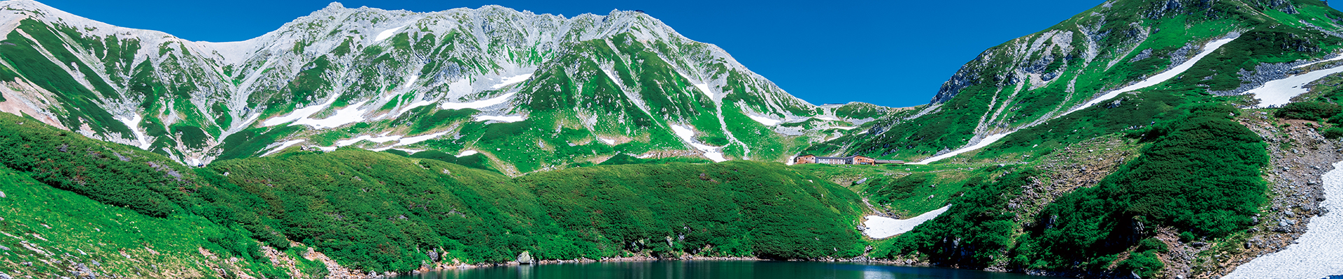
Tateyama Kurobe Alpine Route


- Home /
- Tourist Site Search /
- Tateyama Kurobe Alpine Route
Recommended activities and seasons


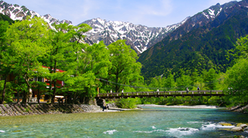
Enjoy Natural Scenery:Mountainous scenery / Alpine plant / Wildlife / Caldera / Waterfall / Snowfall scenery
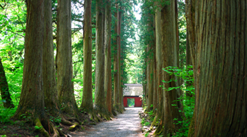
Encounter History and Tradition:Historic building
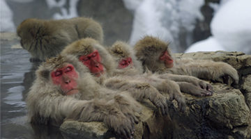
Relax in Onsens:Onsen
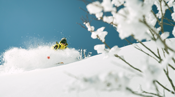
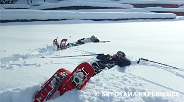
Get Some Exercise:Mountain climbing / Hiking / Snow playing

Spring / Summer / Autumn
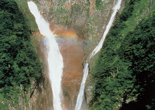

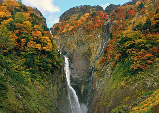
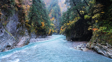
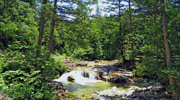
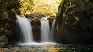
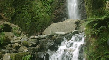
You’ll want to see this at least once! The most exciting waterfall in Japan: Shomyo Falls.
The Shomyo River has its source on Mount Tateyama, and at the Shomyo Falls it plummets down the face of a deeply eroded cliff. The drop of 350 meters makes this the highest waterfall in Japan, and the government has designated it as a scenic natural monument. The falls descend from the top in four successive stages of 70 meters, 58 meters, 96 meters, and 126 meters, with an additional drop of 30 meters in the uppermost section. Visitors seeing the giant waterfall right before their eyes are struck speechless.
In the spring, the flow of water from the melting snow on Mount Tateyama causes the Hannoki Falls, with a drop of 500 meters, to appear to the right of the Shomyo Falls. The spectacle of these two waterfalls plunging into a basin 60 meters wide and 6 meters deep, with clouds of spray rising from it, is the very essence of the dynamic power of nature. And if the water flow is particularly heavy, lucky visitors may be presented with the rare sight of multiple small waterfalls streaming down the surrounding cliffs. The Shomyo Falls face toward the west, so if you visit in the afternoon, you might even have the chance to see a rainbow! With green vegetation in the summer and colorful foliage in the autumn, visitors can enjoy the seasonal variation in the rich natural environment along with the changing face of the powerful waterfall.
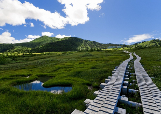
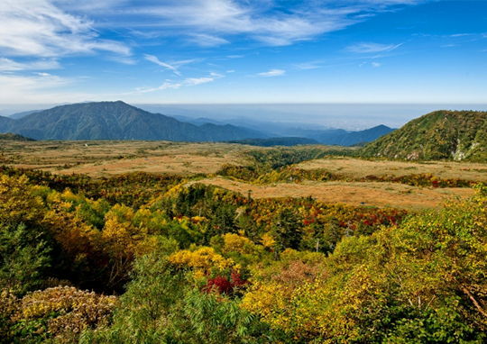
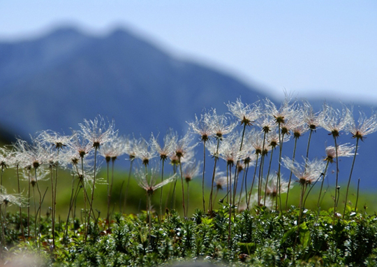
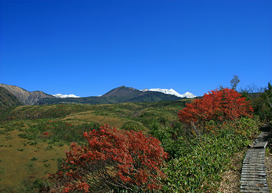
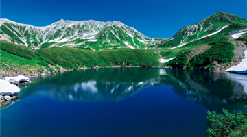
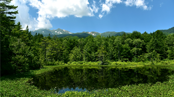
A treasure-trove of alpine vegetation in a Ramsar Convention Wetland: Midagahara.
At Midagahara, with its wooden walkways extending across the wetland as far as the eye can see, you can truly immerse yourself in nature. Midagahara is a highland area spread over a gently sloping lava plateau. It measures three kilometers north to south and 20 kilometers east to west, with its elevation ranging from 1,600 to 2,000 meters. In July, 2012, the area was registered under the Ramsar Convention as a Wetland of International Importance for the preservation of plant and animal species. Midagahara is the highest-altitude Ramsar-registered wetland in all of Japan.
Because Midagahara is a highland that is covered with snow for about half of the year and filled with the meltwater from residual snow in the warmer months, moisture-loving alpine plants can be seen there in great profusion. Small ponds called gakinota are interspersed throughout the area, creating a distinctive landscape.
Visitors strolling the wooden walkways in July and August encounter delicate alpine plants such as Hemerocallis esculenta, Aleutian avens, cinquefoil, Tateyama gentian, and cotton sedge. In early October, when the trees that cover the mountain slopes are a riot of red and gold, the wetland is also alive with brilliant autumn color.
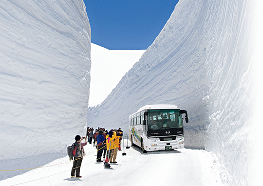
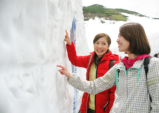
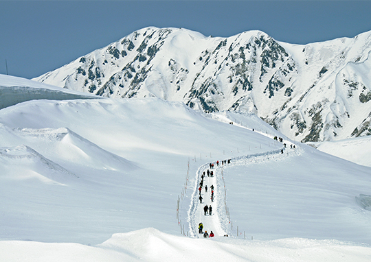
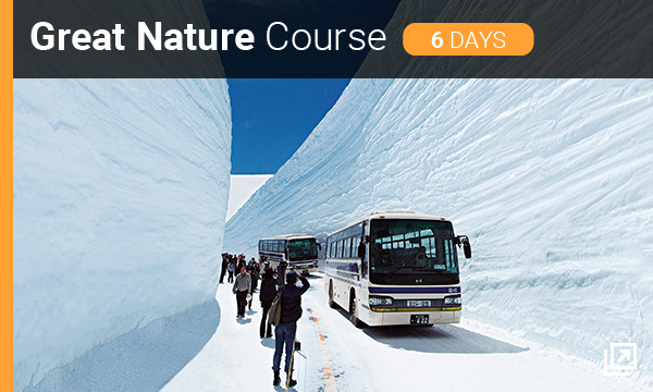
Experience the giant wall of sparkling snow: Walk the Snow Corridor.
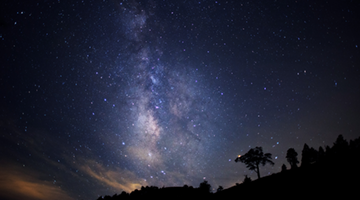
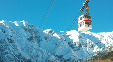
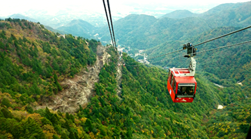
The Tateyama Kurobe Alpine Route runs through the Northern Alps at altitudes close to 3,000 meters, connecting Toyama Prefecture and Nagano Prefecture. The road is closed in the winter, but from mid-April, immediately after the entire route is opened, until around late-June, the road is flanked by a giant wall of natural snow.
At an elevation of 2,450 meters, the area around the Murodo Plain is famous as the site of some of the heaviest snowfall in Japan. The accumulation in the Snow Corridor is particularly great, with the snow piling up to heights of more than 20 meters. Accordingly, when the route is dug through the area, which requires about a month of continuous snow removal, the final result is a giant, 20-meter wall of snow that looms over the road.
Starting from the Murodo Bus Terminal, the highest-altitude bus station in Japan, a section of the route about 500 meters long (the Snow Corridor) is open only to pedestrians. Events are staged there to let visitors touch the magnificent wall of snow and enjoy their time in a world of whiteness. Try carving a message in the snow wall’s message area, and take a photo as a memento. Go for a walk over the snow along the panorama road, where you can view the Tateyama mountains. And don’t forget to visit the snow maze! The Snow Corridor is the one place on Earth where you can spend the perfect winter day, even in the spring.
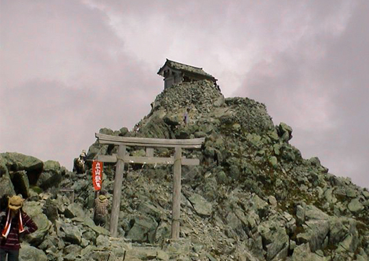
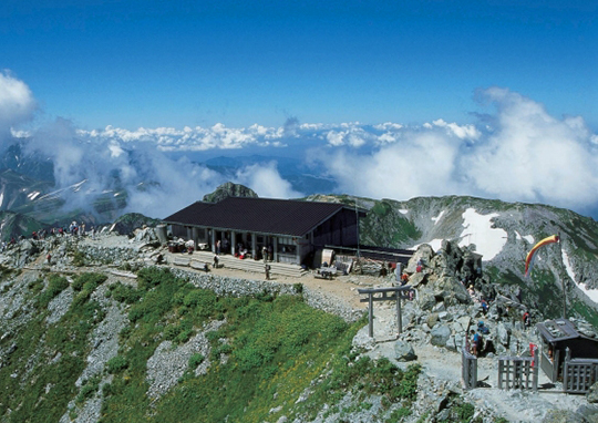
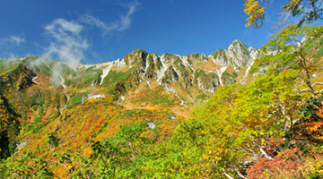
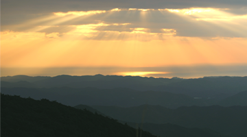
A spot of mystical power with a 360-degree view: Oyama Shrine.
At an elevation of 3,003 meters, Oyama is one of the three peaks that make up Mount Tateyama. Oyama Shrine is located at the summit of Oyama, a scenic region from which you can gaze out at the distant Mount Fuji, as well as Mount Ontake, the headwaters of the Kurobe River, and Toyama Bay. Summer is the season for climbing Oyama. Starting out from the Murodo Bus Terminal, one can reach the summit in about two hours, spending the entire time enshrouded in nature.
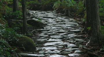
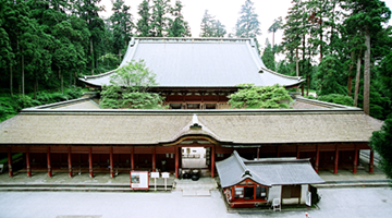
Along the route are spots that tell the story of how Mount Tateyama was worshipped as a sacred mountain, and it is worth the climber’s while to seek them out. The first place to see is Tateyama Murodo, Japan’s oldest mountain hut and a government-designated Important Cultural Property, which was built in the middle of the Edo Period. Climb for another forty minutes on the stone-paved path to reach a small shrine called the Haraido, a place that, in Tateyama worship, was regarded as marking the boundary between the outside world and the sacred realm. This was traditionally the place where pilgrims would purify themselves before going to worship at the summit. Along the way, we pass a series of small shrines, from the Ichinokoshi to the Yonnokoshi, and then we’re at the summit! We have completed the mountain pilgrimage to Oyama Shrine while being soothed by the grand natural environment of Mount Tateyama.
Tateyama Kurobe Alpine Route
Address |
National Forest, 11 Bunazaka, Ashikuraji, Tateyamamachi, Nakaniikawa-gun, Toyama Prefecture |
|---|---|
Hours |
Varies depending on time of year |
Closed |
Closed in winter |
Cost |
Dentetsu Toyama Sta. to Tateyama Sta. one way: adult 1,200 yen; child (age 6 through 11), 600 yen; etc. Group discounts available (more than 15 persons) |
Phone |
076-432-2819 |
Access |
By train to Toyama Chiho Tateyama Line Tateyama Sta. |
Web site |
http://www.alpen-route.com/ |


Other Spots
-
-
Oiwasan Nissekiji Temple

Toyama

Natural Scenery
History and Traditions
Onsen
Spring
Summer
Autumn
-
Tateyama Kurobe Alpine Route
Toyama
Natural Scenery
History and Traditions
Onsen
Exercise
Spring
Summer
Autumn
-
-
Shirayama Hime Shrine
Ishikawa
Natural Scenery
History and Traditions
Exercise
Spring
Summer
Autumn
Winter
-
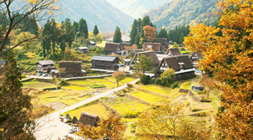
Hakusan Shirakawa-go White Road
Ishikawa
Natural Scenery
Exercise
Spring
Summer
Autumn
-
-
-
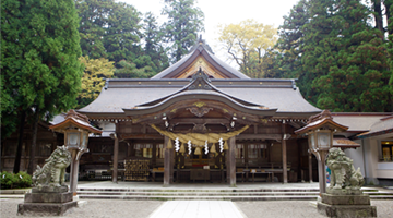
Hakusan Heisenji Shrine
Fukui
History and Traditions
Exercise
Spring
Summer
Autumn
-
-
Rainbow Line Summit Park
Fukui
Natural Scenery
Exercise
Spring
Summer
Autumn
Winter
-
-
-
Togakushi Kodo
Nagano
Natural Scenery
History and Traditions
Exercise
Spring
Summer
Autumn
Winter
-
-
Heavens Sonohara
Nagano
Natural Scenery
Exercise
Spring
Summer
Autumn
Winter
-
Akasawa Natural Recreational Forest
Nagano
Natural Scenery
Exercise
Spring
Summer
Autumn
-
Norikura Highlands
Nagano
Natural Scenery
Onsen
Exercise
Spring
Summer
Autumn
Winter
-
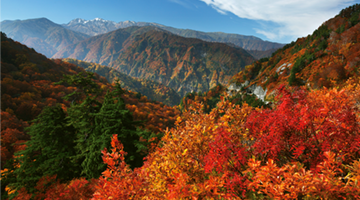
Senjojiki Cirque
Nagano
Natural Scenery
Exercise
Spring
Summer
Autumn
Winter
-
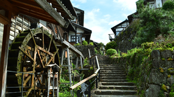
Magome-juku
Gifu
Natural Scenery
History and Traditions
Exercise
Spring
Summer
Autumn
Winter
-
The Waterfalls of Osaka
Gifu
Natural Scenery
Exercise
Spring
Summer
Autumn
Winter
-
-
-
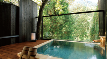
Shinhotaka Ropeway
Gifu
Natural Scenery
Onsen
Exercise
Spring
Summer
Autumn
Winter
-
SATOYAMA EXPERIENCE
Gifu
Natural Scenery
Exercise
Spring
Summer
Autumn
Winter
-
-
Mount Fuji
Shizuoka
Natural Scenery
History and Traditions
Exercise
Spring
Summer
Autumn
Winter
-
Izu Peninsula Geopark
Shizuoka
Natural Scenery
Exercise
Spring
Summer
Autumn
Winter
-
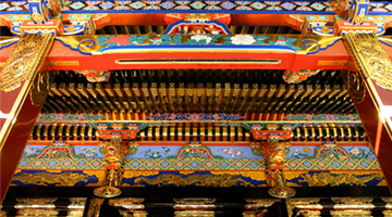
Kunozan Toshogu Shrine
Shizuoka
History and Traditions
Spring
Summer
Autumn
Winter
-
Chausuyama Highlands
Aichi
Natural Scenery
Exercise
Spring
Summer
Autumn
Winter
-
-
Kumano Kodo Pilgrimage Routes
Mie
Natural Scenery
History and Traditions
Exercise
Spring
Summer
Autumn
Winter
-
Mount Asama
Mie
Natural Scenery
History and Traditions
Exercise
Spring
Summer
Autumn
-
-
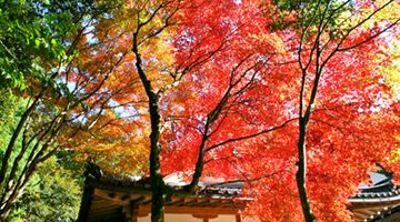
Enryakuji Temple on Mount Hiei
Shiga
History and Traditions
Spring
Summer
Autumn
Winter
-
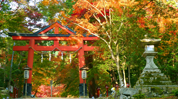
Hiyoshi Taisha Shrine
Shiga
History and Traditions
Spring
Summer
Autumn
Winter
-


See Other Routes


The Four Shoryudo Routes
- Useful Information -