Kamikochi


- Home /
- Tourist Site Search /
- Kamikochi
Recommended activities and seasons


Enjoy Natural Scenery:Mountainous scenery / Valley
Get Some Exercise:Trekking

Spring / Summer / Autumn
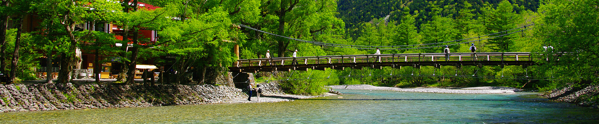
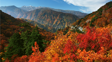
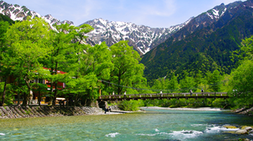
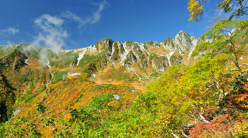
Kamikochi: A scenic area that symbolizes Japan.
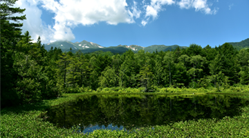
Kamikochi, a scenic area among mountains at an elevation of 1500 meters, is a mountain resort that symbolizes Japan. The gorgeous surroundings, from the beautiful slopes of the Hotaka Mountains to the clear flow of the Azusa River, ponds small and large, and the trees of the deep forest, appeal to all of the five senses. A particular charm of the area is the variety of ways in which visitors can enjoy their time surrounded by nature, from trekking to full-scale mountain-climbing, from easy day trips to long-term overnight stays.
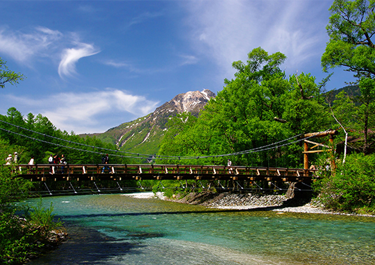
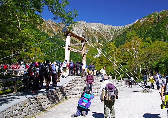
If there is one place that could be called the symbol of Kamikochi, it would be Kappabashi, a wooden suspension bridge over the Azusa River. It is the perfect spot from which to gaze upon the beautiful river, as well as to take in the view of the Hotaka Mountains and nearby Mount Yakedake.
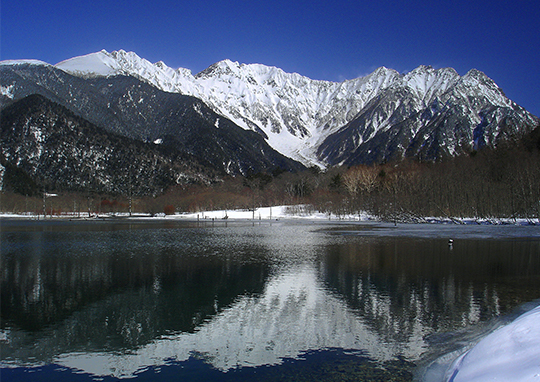
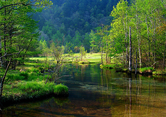
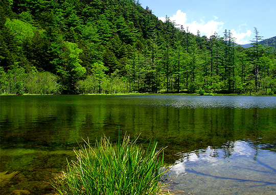
There’s no end to the sights to be seen in Kamikochi! Taisho Pond, whose still surface reflects the magnificent profile of the Hotaka Mountains, was formed when a massive mud flow from an eruption of Mount Yakedake dammed up the Azusa River. The trees that were submerged as a result withered in place, creating an otherworldly scene. Tashiro Pond is a shallow, marshy pond on a grassy plain surrounded by old growth forest. The scenery of Kamikochi enchants visitors throughout the four seasons, from the fresh verdure of spring and the Nikko day lilies and lingonberry blossoms that bloom in the summer, to the hoarfrost of late autumn.
A sacred place for nature, cradled among the Hotaka Mountains.
An hour’s walk upstream along the Azusa River from Kappabashi brings you to Myojin Pond, which actually comprises two ponds. Hotaka Shrine is situated on one side of the pond, rendering the whole area sacred. Large rocks are arranged in middle of the pond, and the still, transparent surface of the water reflects the greenery of kuma bamboo grass and chosenias. Nearby Mount Myojin dominates the view, creating a mood that can only be called mystical.
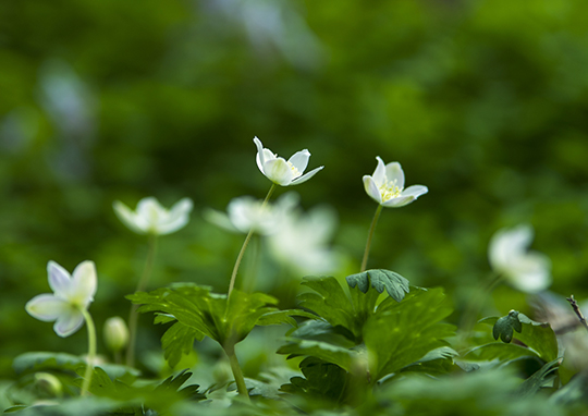
Heading farther upstream from Myojin Pond, one comes to Tokusawa, a bright, open grassy plain that was formerly a pasture. In May, white clusters of anemones are in bloom, combining with the surrounding greenery to create a rich natural atmosphere. This is the perfect spot for trekking and camping within view of the magnificent Hotaka Mountains.
In order to protect the precious natural environment of Kamikochi, access by private car is prohibited. Park your car in the parking lot at Sawando or Hirayu, then travel to Kamikochi by bus or taxi. Restaurants and hotels are mostly located around the bus terminal and the Kappabashi, where tourists gather in large numbers.
Kamikochi
Address |
Azumikamikochi, Matsumoto, Nagano Prefecture |
|---|---|
Hours |
Kamikochi Information Center 8:00 am to 5:00 pm |
Closed |
Nov. 16 – Apr. 27 |
Cost |
Free of charge |
Phone |
Kamikochi Information Center 0263-95-2433 |
Access |
By Alpico Kotsu Route Bus from Matsumoto Dentetsu Kamikochi Line Shin-Shimashima Sta. to Kamikochi, about 80 min |
Web site |
http://www.kamikochi.or.jp/ |


Other Spots
-
-
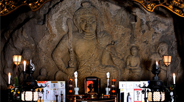
Oiwasan Nissekiji Temple

Toyama

Natural Scenery
History and Traditions
Onsen
Spring
Summer
Autumn
-
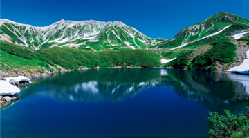
Tateyama Kurobe Alpine Route
Toyama
Natural Scenery
History and Traditions
Onsen
Exercise
Spring
Summer
Autumn
-
-
Shirayama Hime Shrine
Ishikawa
Natural Scenery
History and Traditions
Exercise
Spring
Summer
Autumn
Winter
-
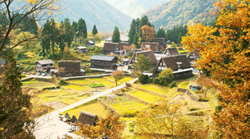
Hakusan Shirakawa-go White Road
Ishikawa
Natural Scenery
Exercise
Spring
Summer
Autumn
-
-
-
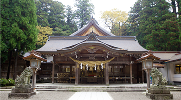
Hakusan Heisenji Shrine
Fukui
History and Traditions
Exercise
Spring
Summer
Autumn
-
-
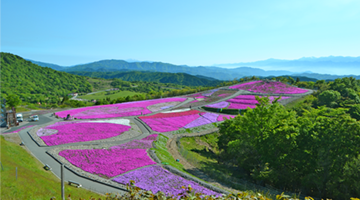
Rainbow Line Summit Park
Fukui
Natural Scenery
Exercise
Spring
Summer
Autumn
Winter
-
-
-
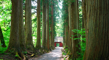
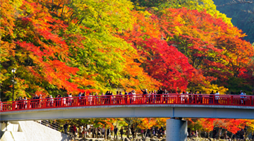
Togakushi Kodo
Nagano
Natural Scenery
History and Traditions
Exercise
Spring
Summer
Autumn
Winter
-

-
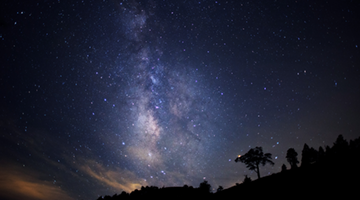
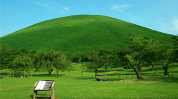
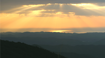
Heavens Sonohara
Nagano
Natural Scenery
Exercise
Spring
Summer
Autumn
Winter
-
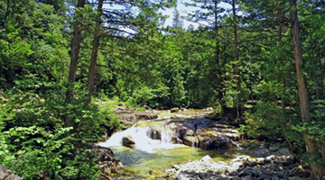
Akasawa Natural Recreational Forest
Nagano
Natural Scenery
Exercise
Spring
Summer
Autumn
-
Norikura Highlands
Nagano
Natural Scenery
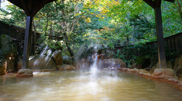
Onsen
Exercise
Spring
Summer
Autumn
Winter
-
Senjojiki Cirque
Nagano
Natural Scenery
Exercise
Spring
Summer
Autumn
Winter
-
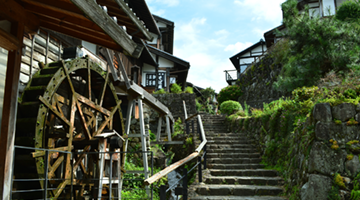
Magome-juku
Gifu
Natural Scenery
History and Traditions
Exercise
Spring
Summer
Autumn
Winter
-
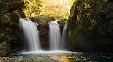
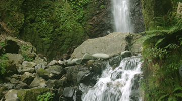
The Waterfalls of Osaka
Gifu
Natural Scenery
Exercise
Spring
Summer
Autumn
Winter
-
-
-
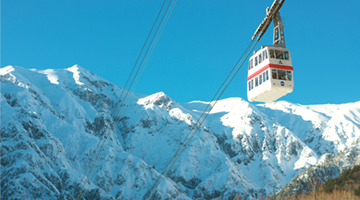
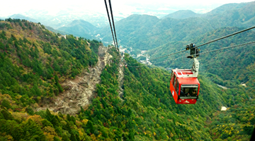
Shinhotaka Ropeway
Gifu
Natural Scenery
Onsen
Exercise
Spring
Summer
Autumn
Winter
-
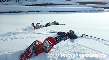
SATOYAMA EXPERIENCE
Gifu
Natural Scenery
Exercise
Spring
Summer
Autumn
Winter
-
-
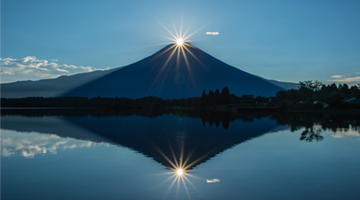
Mount Fuji
Shizuoka
Natural Scenery
History and Traditions
Exercise
Spring
Summer
Autumn
Winter
-
Izu Peninsula Geopark
Shizuoka
Natural Scenery
Exercise
Spring
Summer
Autumn
Winter
-
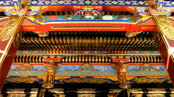
Kunozan Toshogu Shrine
Shizuoka
History and Traditions
Spring
Summer
Autumn
Winter
-
Chausuyama Highlands
Aichi
Natural Scenery
Exercise
Spring
Summer
Autumn
Winter
-
-
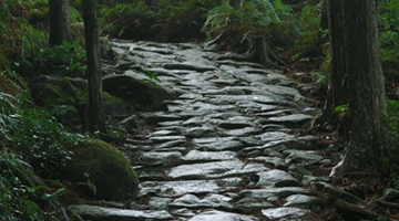
Kumano Kodo Pilgrimage Routes
Mie
Natural Scenery
History and Traditions
Exercise
Spring
Summer
Autumn
Winter
-
Mount Asama
Mie
Natural Scenery
History and Traditions
Exercise
Spring
Summer
Autumn
-
-
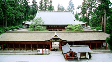
Enryakuji Temple on Mount Hiei
Shiga
History and Traditions
Spring
Summer
Autumn
Winter
-
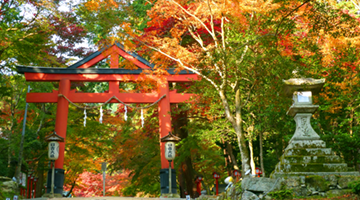
Hiyoshi Taisha Shrine
Shiga
History and Traditions
Spring
Summer
Autumn
Winter
-


See Other Routes

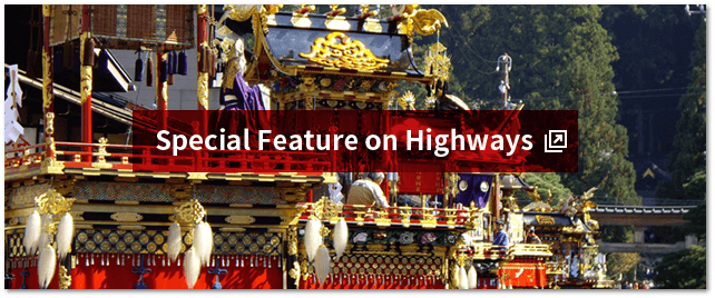


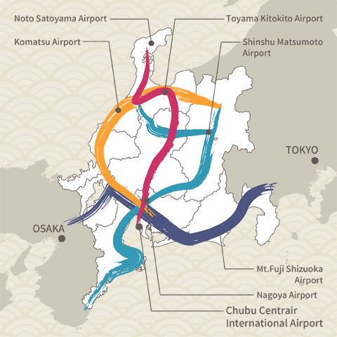
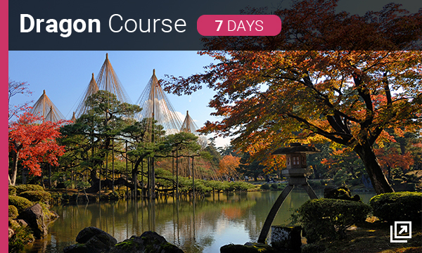
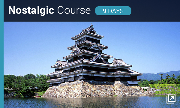
The Four Shoryudo Routes


- Useful Information -